How to get maximum value from satellite monitoring: EOS Crop Monitoring case study
Sponsored content provided for AgWired by EOS Crop Monitoring
Finding the reason behind low field performance could be tricky. Often seems there were no pests and fertilizers properly applied, but somehow results are unsatisfactory. EOS Crop Monitoring case study illustrates how satellite data enables problem-solving on a field.
Satellite monitoring in a nutshell
Satellite crop monitoring is an online-based technology that enables ground surface analysis for vegetation levels assessment. This allows to track plant development dynamics and identify problem spots on a field without leaving the office. Other features include weather prediction tools, rainfall information, and field historical data. Insights from satellites are visualized in software platforms for efficient field management.
How to detect issues on a field via satellites
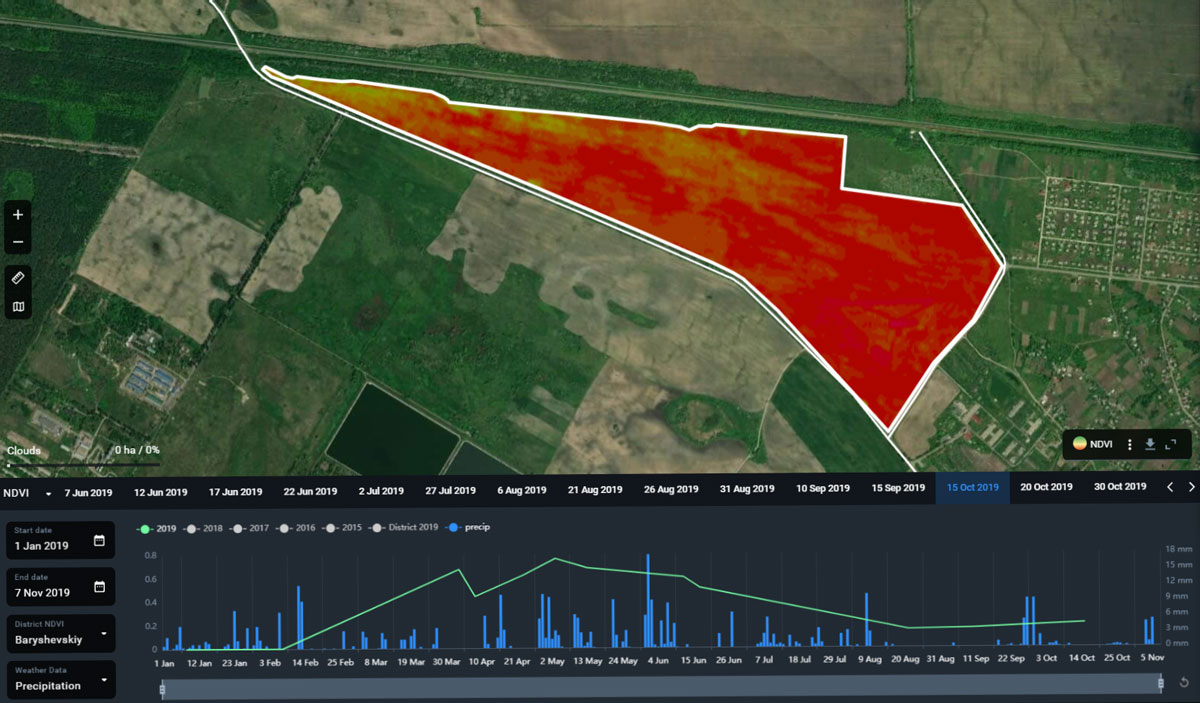 In October 2019, EOS Crop Monitoring team was requested to identify the reason behind low NDVI readings. NDVI (normalized difference vegetation index) is a formula that estimates near-infrared light reflected from the Earth’s surface to assess vegetation conditions. The platform reported sparse plant performance which in NDVI spectra is visualized in shades of red. (click on image for larger version)
And in order to examine sprouts conditions, the EOS team joined up with an agronomist and traveled to the area. Pictures directly from the field confirmed low quantity and quality of the sprouts: Read More


 Appropriately on World Soil Day,